Our diploma thesis aims at the synthesis of memory “splices” across a cultural walk path, based on the existing historical prints found on Elounda’s landscape.
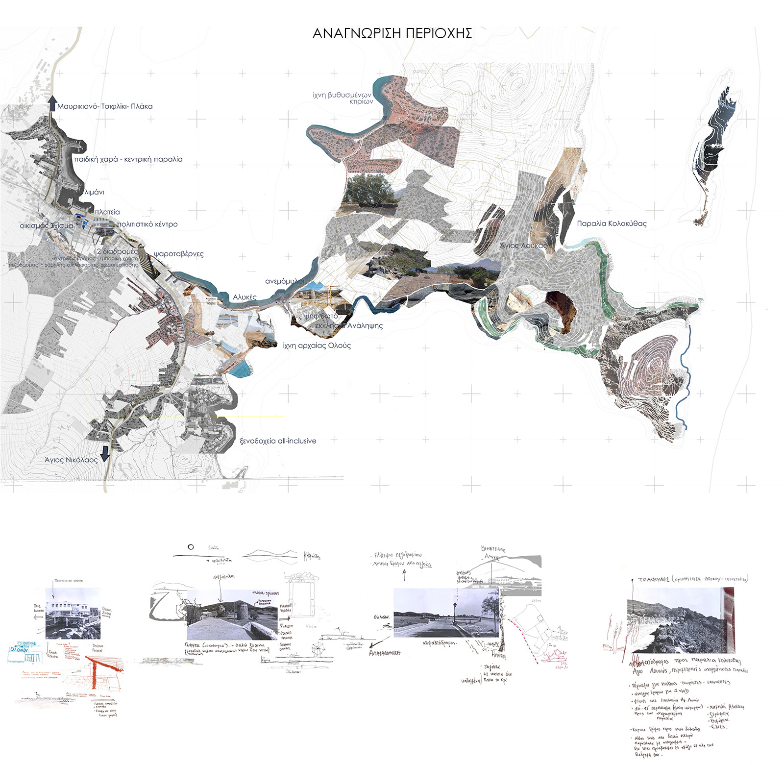
Tourism, nature and history have been the main interests of the region under study. A landmark year is 1970 when economic growth shifts towards tourism rather than agriculture and farming. (1)
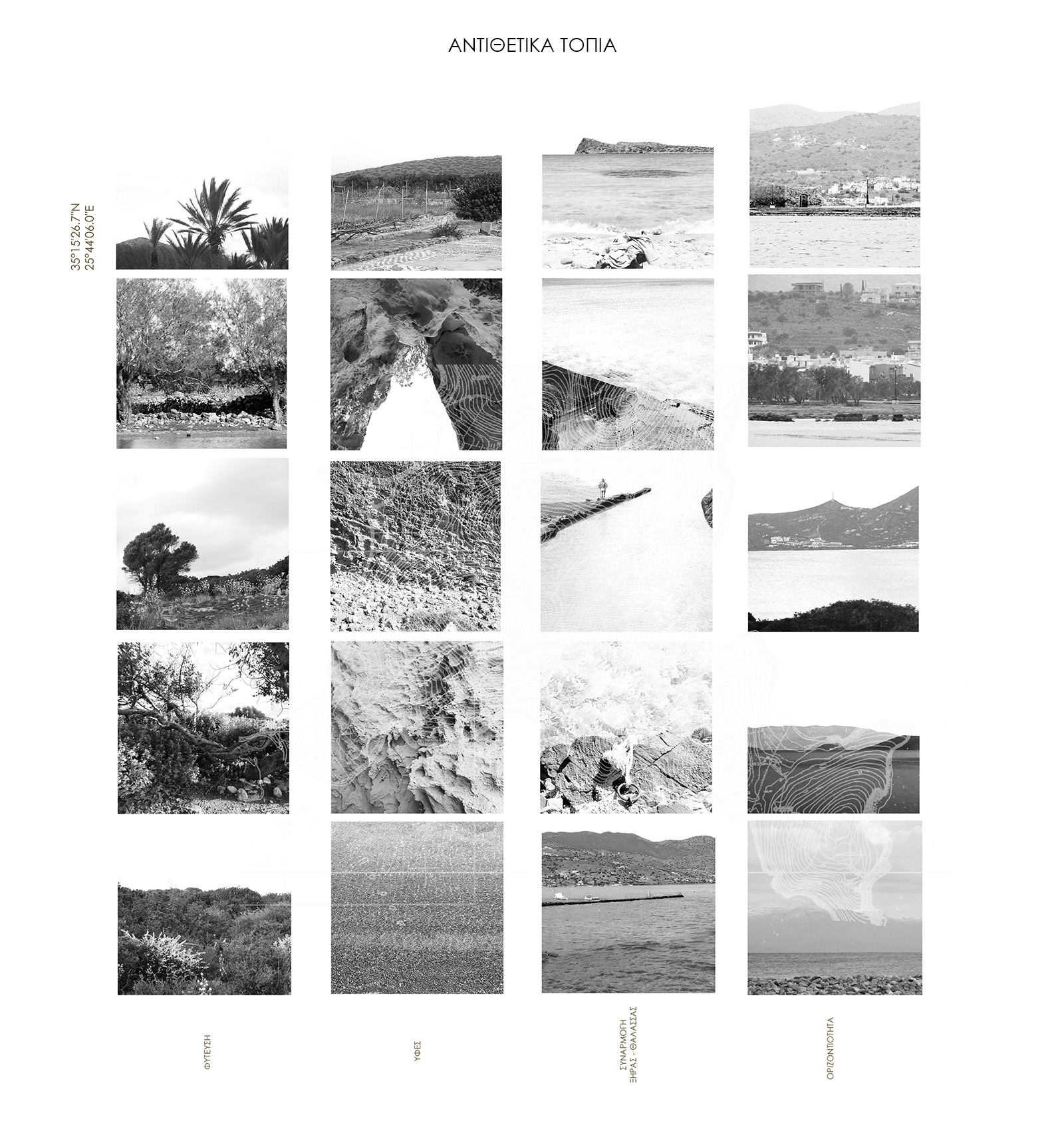
The co-existence of the rocky terrain, the touristic coastline and historical prints creates a place rich in opposed landscapes. (2)
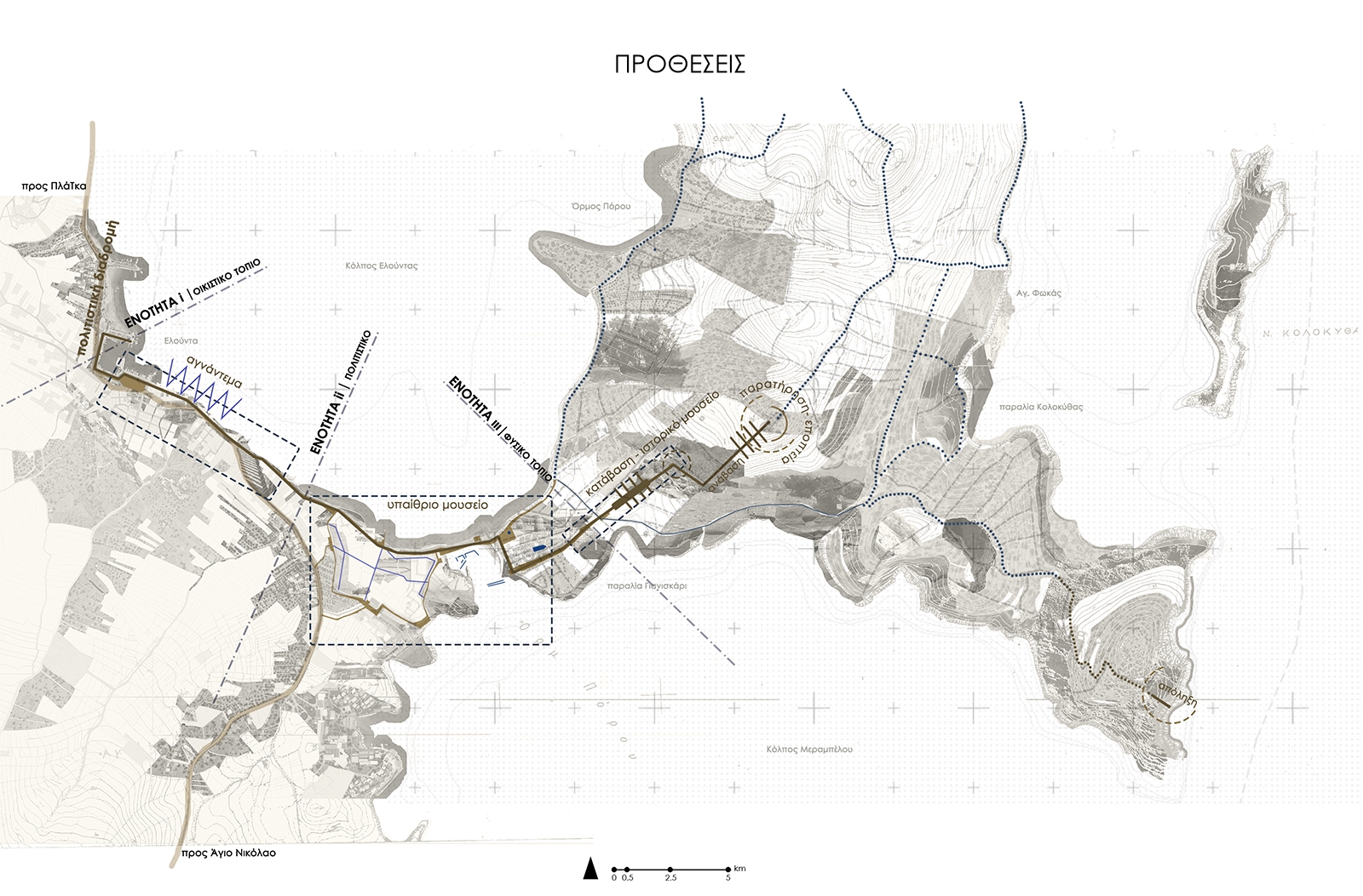
We have detected 3 main landscape characters: residential landscape (Elounda village, coastline), cultural landscape (saltpans, salt barns, windmills, early Christian basilica of Kolokytha) and the natural landscape (Kolokytha island).
In order to connect the aforementioned landscapes, we have created a cultural path based on the history of the land. Coastal acupuncture works together with interventions around the saltpans and lead towards the museum/ archaeological research center. There the visitor can find all the elements that had been previously observed. (3)
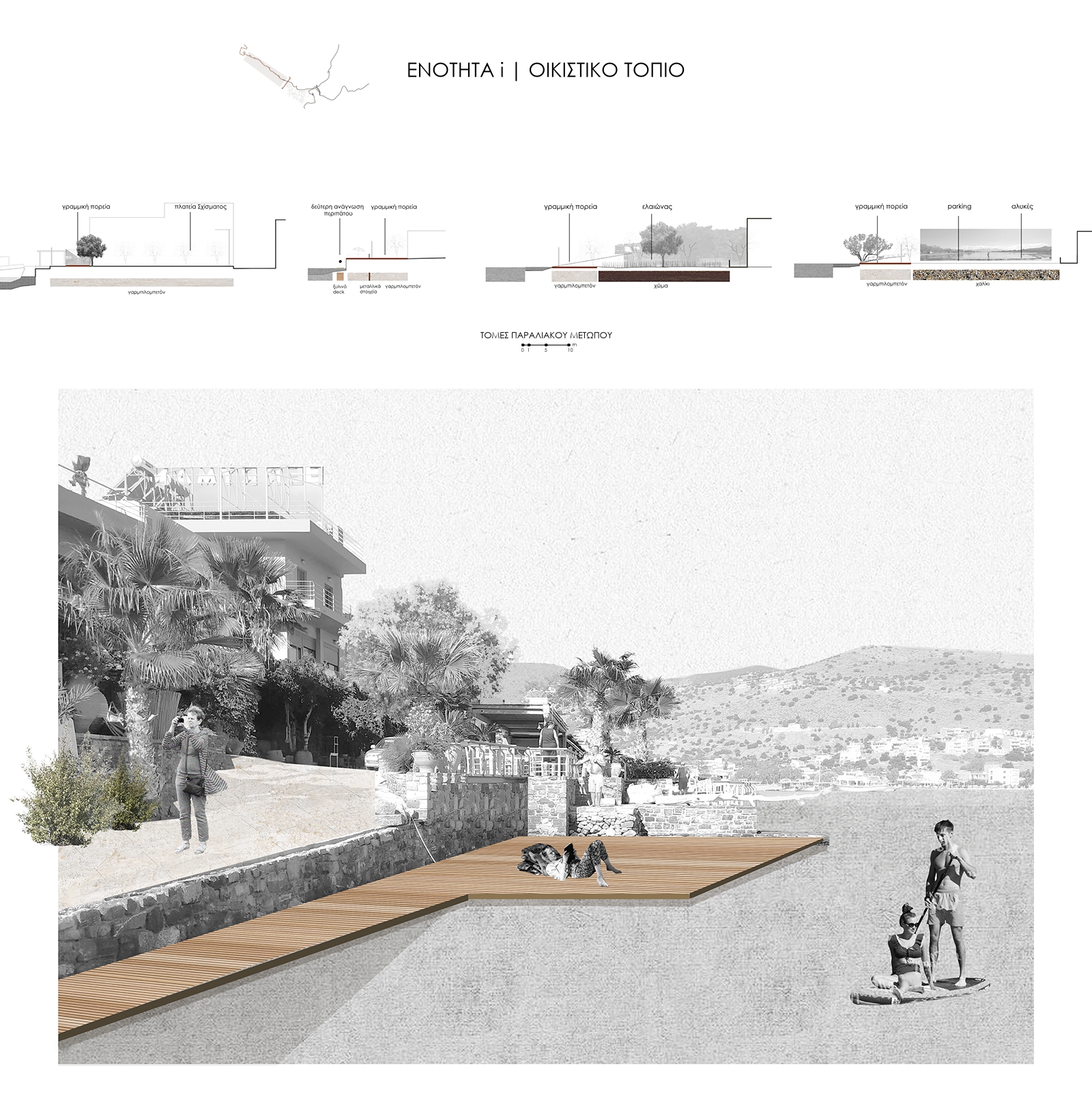
|first section| residential landscape: seating areas, walking paths, coastline design, green spaces
The main purpose is to achieve an interaction of all the different spatial qualities that exist along the coastline.(4)
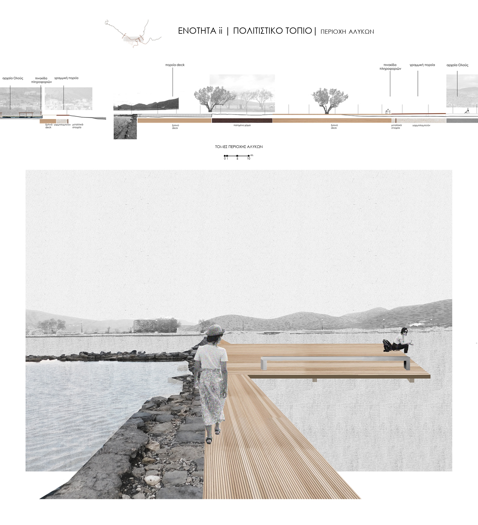
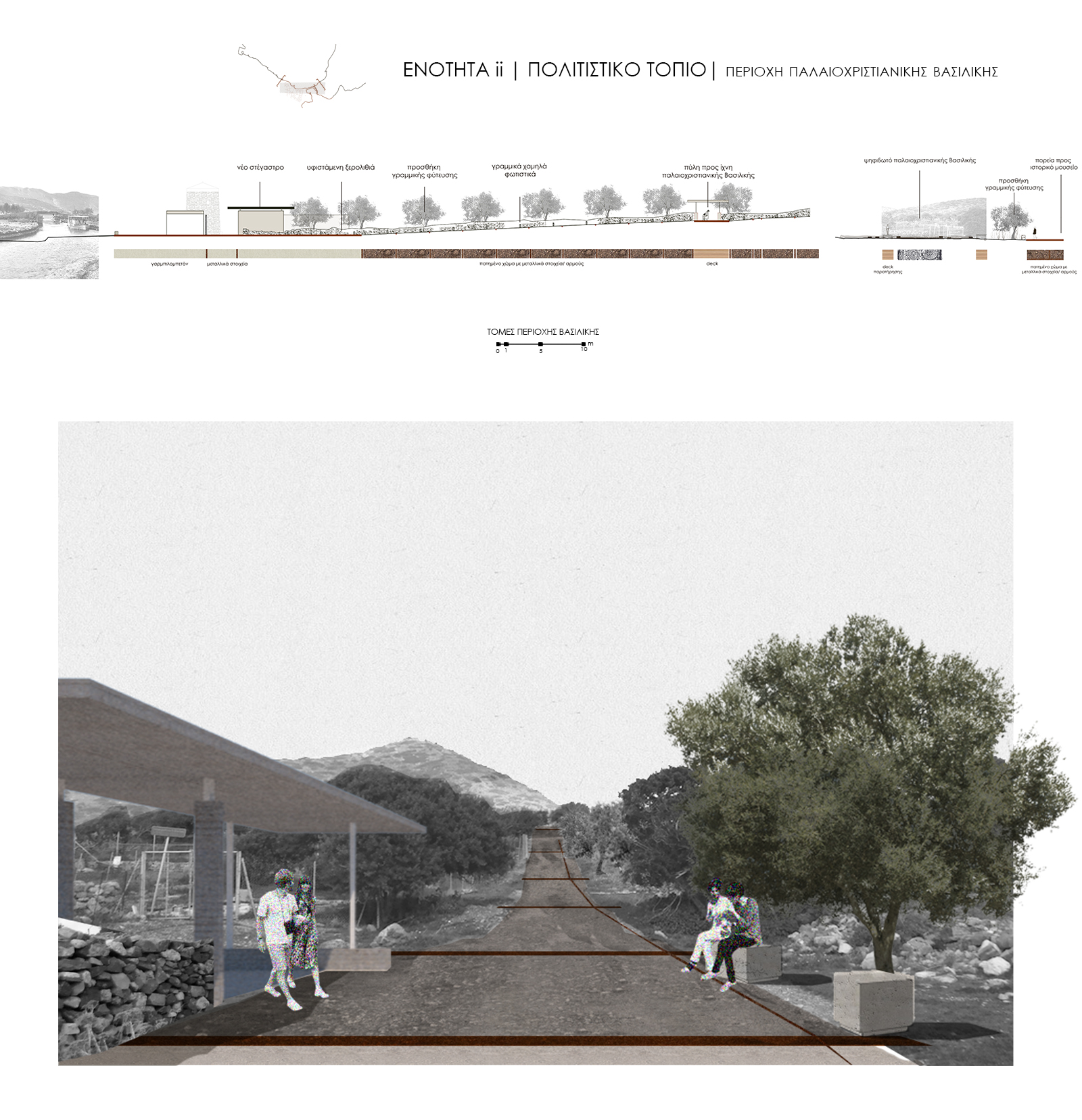
|second section| cultural landscape: open-space museum
We divide this section into two sub-sections.
The first one consists of the salt pants and all the architectural elements around them. In order to ensure an experiential approach of the space, we have created a network of wooden decks that connect all the elements (salt pants, storage rooms, underwater ancient Olous). (5)
The second section includes the area around the early Christian Basilica of Kolokytha. The cultural path passes through a new “gate” comprising of an information desk, public toilets and a cooperative center. Through this, the visitor is led to the entrance of an underground historical museum. (6)
|third section| natural landscape: design in the wider area of Kolokytha Island and the historical museum-research center.
We have redefined the walking routes around Kolokytha island, and designed seating areas ideal for observing the Mirabello and Elounda bays.
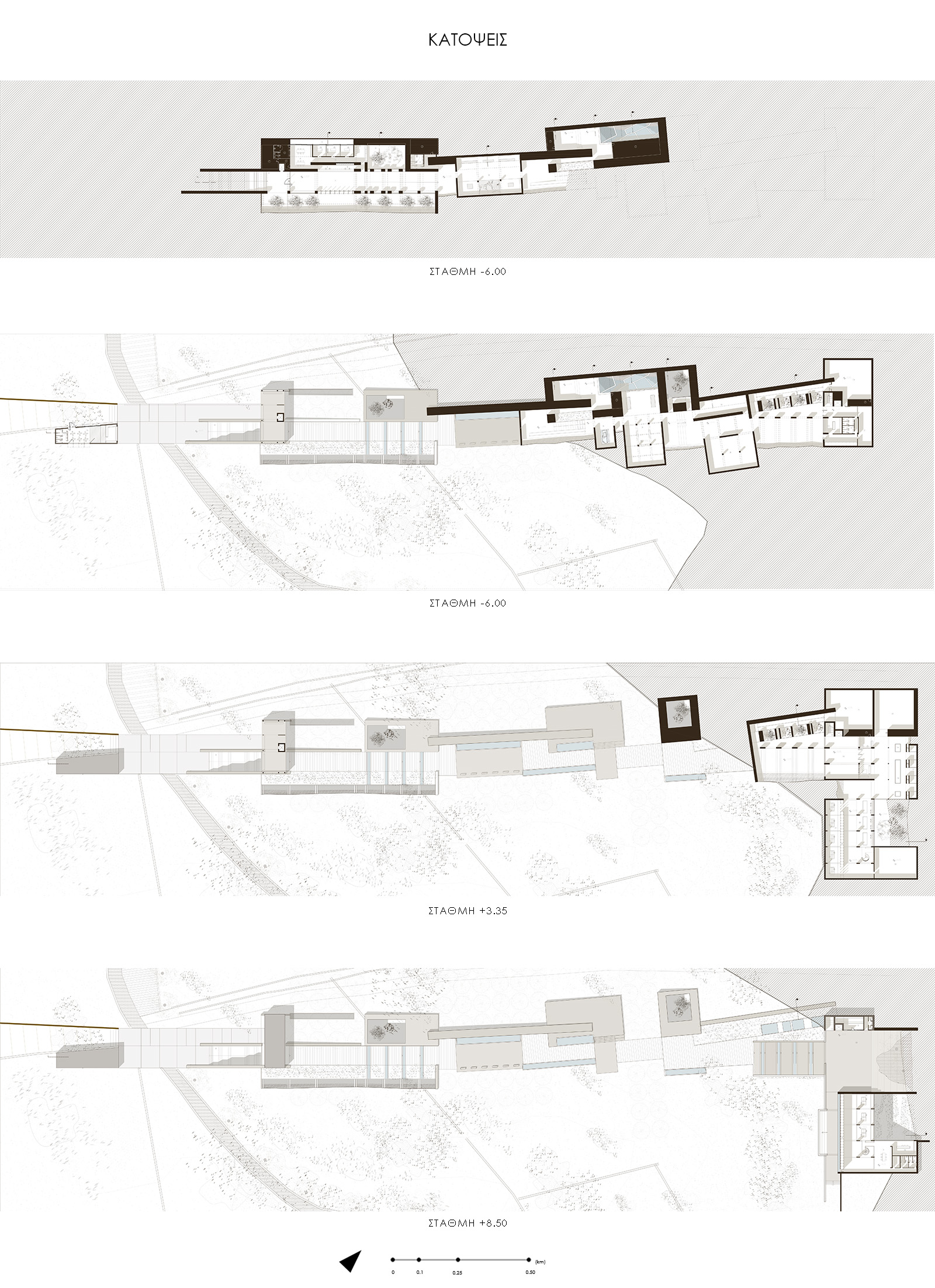
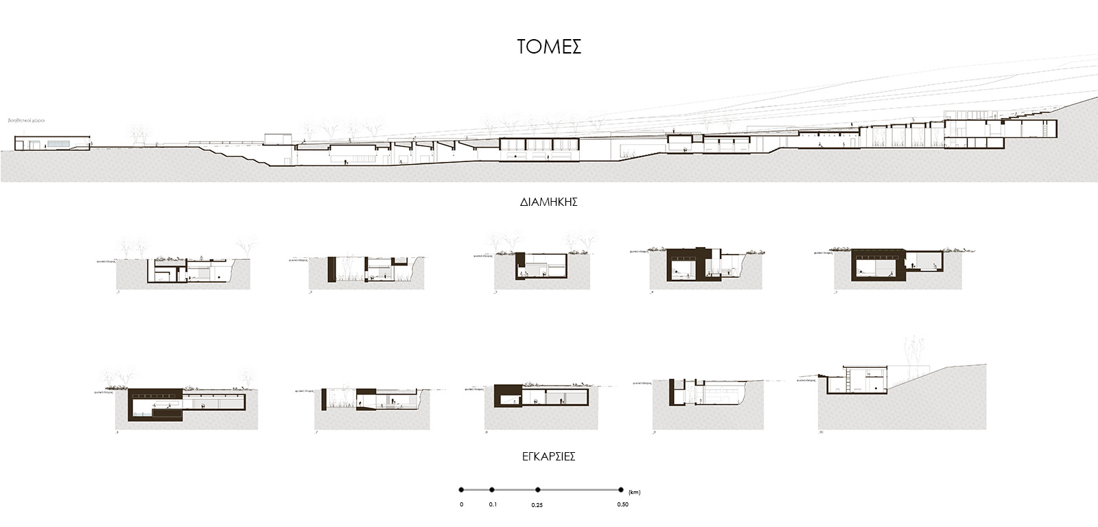
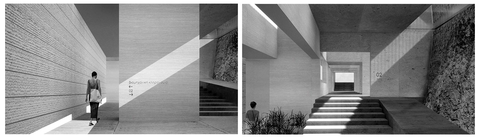
As far as the archaeological research center is concerned we have tried to create a synthesis of “splices” on a new solid element, divided by the natural element. Tools of this synthesis are the existing geology, hard light/ shadow, local vegetation and materials.
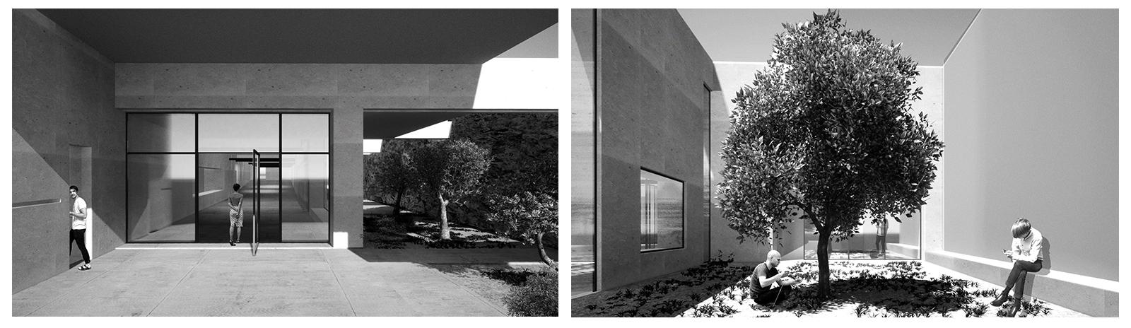
The museum starts with a foyer which leads to four separate rooms acting as “rooms of memory”. The visitor can recognize the different functions of the spaces due to the different textures of the concrete used. The whole synthesis is based on the coexistence of two contradictory spatial qualities. The main collection, where findings and models are exhibited in open clean spaces, whereas installations and projections are found in dark solid rooms. The museum ends with a gathering place and a multi-level connection shaped in a vertical fashion, between the entrance of the archaeological research center and the open amphitheater.
The archaeological research center functions in two levels. The first one is related to the washing, listing, classification and storage of the research findings. In the second level there is a library, offices and auxiliary space for the center. (7),(8)
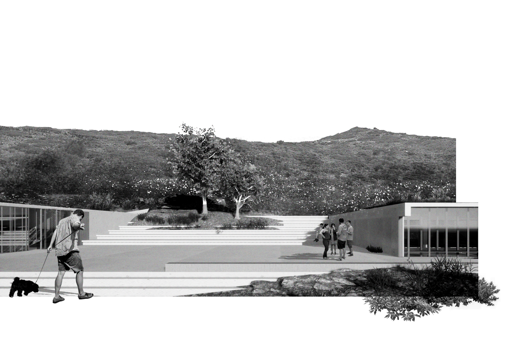
In parallel, an over ground walk path with green spaces and seating spots leads to the open amphitheater. The design of this walk path is based on the prints that the plan of the underground museum has left on the landscape.(9), (10)